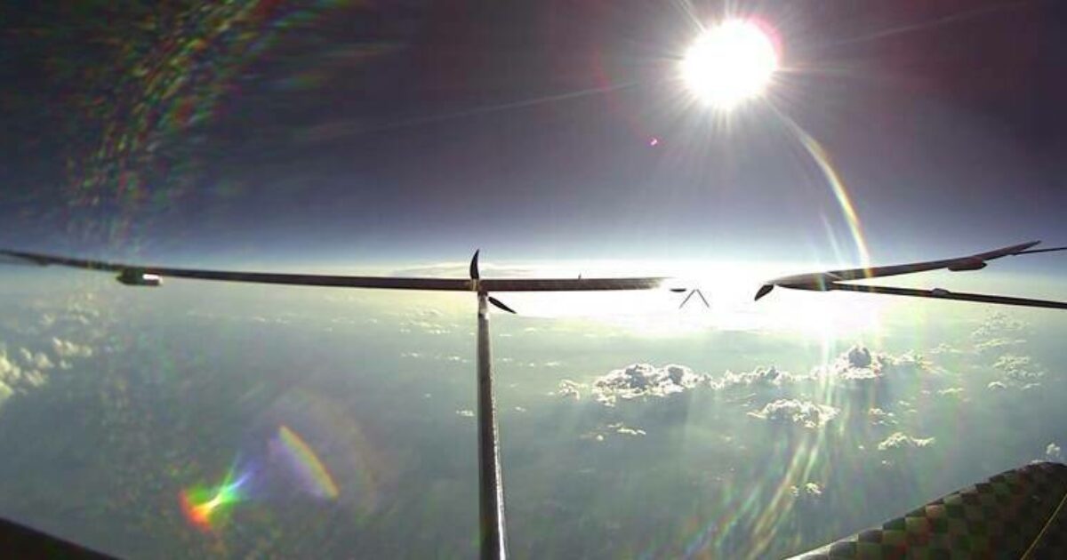
When GPS Went Dark at 52,500 Feet, a Camera Kept This Drone on Course
UAVOS and Mira Aerospace's NAVAI module held the ApusNeo18 HAPS on a precise navigation track through GNSS-denied skies at 16,000 meters, using only onboard cameras and telemetry.
Source material: geoconnexion.com
The Flight That Lost Its Satellites
At 16,000 meters — about 52,500 feet — the ApusNeo18 pseudo-satellite flew with its GNSS signals unavailable. UAVOS and Mira Aerospace fitted the stratospheric aircraft with NAVAI, a vision-based navigation module, and the flight test asked whether onboard cameras could carry the positioning workload alone. They did. NAVAI kept the aircraft on a precise navigation track under GNSS-denied conditions, drawing on video streams from its cameras and aircraft telemetry to maintain accurate positioning. What makes that significant is the altitude regime: HAPS aircraft fly where the air is thin and the ground sits far below, and navigation errors at that height are not small problems. The test validates a navigation path for HAPS operations that doesn't depend on a satellite constellation staying healthy overhead. For a class of aircraft designed to loiter in the stratosphere on long missions, the ability to lose GNSS and keep flying a defined track is the difference between a system that degrades gracefully and one that fails outright.
The GNSS Dependency That Erodes
Conventional unmanned aircraft treat satellite navigation as infrastructure they can assume. Positioning flows from GNSS signals, and that arrangement works until the signals are jammed, spoofed, or disrupted by natural interference — three failure modes both military and civil operators plan around. The standard fallback is an inertial navigation system (INS), which tracks movement without external signals but carries a structural weakness: navigational drift. Position errors accumulate over time, so the longer the satellite outage, the less trustworthy the INS position becomes. The erosion is gradual, which makes it deceptive: a mission that looks fine for the first minutes of an outage can be hopelessly off by the hour. UAVOS and Mira Aerospace built NAVAI to close that gap — not by hardening the satellite link, but by removing the dependence on it entirely. The module draws on cameras already fitted to the aircraft, which means it operates without new hardware on the platform and without any external radio input.
Two Techniques, One Camera Feed
NAVAI pairs two distinct techniques. Visual odometry tracks how the aircraft moves by observing how ground features shift across successive camera frames. Terrain-referenced navigation takes the current frame and matches it against pre-loaded reference imagery of the area below. Together, the methods produce what the module's designers call a bounded, non-drifting absolute position estimate — bounded because every successful match against reference imagery corrects accumulated error, and non-drifting because the correction comes from the terrain itself rather than from the aircraft's own measurements. The system fuses video streams with aircraft telemetry, so it needs nothing beyond the aircraft's existing sensors to compute where it is. The two methods answer different questions: odometry says how the aircraft has moved since its last known position, while terrain matching says where the aircraft is right now. Used together, they keep each other honest — which is exactly what an INS backup cannot do.
A Single Frame Is All It Needs
Stratospheric flight is a sparse environment for visual navigation. At that altitude, the terrain features a low-flying aircraft would use — distinct buildings, road networks, field boundaries — compress into far less visual detail, and the ground recedes into broad, feature-poor sweeps. NAVAI was built for this regime, and it holds a capability that matters there: when suitable terrain is visible, the module can obtain a position fix from a single frame. That shortens the time an aircraft needs to re-establish an absolute position, and it means the navigation system doesn't depend on sustained feature tracking to stay alive. Position recovery happens the moment usable ground appears in frame, a decisive advantage for a HAPS circling over terrain that offers few reliable landmarks. The narrow visual diet that the stratosphere serves up is exactly what the single-frame fix was designed to handle; the module treats one usable image as a complete navigation event.
Redefining What a Mission Can Tolerate
NAVAI is built to provide uninterrupted positioning for unmanned aircraft, and the ApusNeo18 test flight is the evidence that the capability holds at operational altitude. Sustained operations over regions where satellite navigation is deliberately jammed, or where natural interference degrades reception, become feasible when a platform can shift to camera-based navigation instead of accepting position drift for the duration of the outage. For a HAPS class of aircraft, whose strategic value rests on long endurance at altitude, the navigation backstop changes the tolerance for worst-case mission conditions. The constraint is terrain visibility: NAVAI works when the ground is in view. That is a condition mission planners can map in advance, weigh against the route, and build into the flight plan — a known limitation, not an unknown failure mode. What the test demonstrated is that the module maintains an accurate position without satellite correction, which is the metric that decides whether a mission can proceed or must turn back.
Where this came from. This breakdown is based on source material published at geoconnexion.com. Images above are used with the credits shown beneath each one.